Steve Thornton attempts to ride the ten best roads in the state of Washington. But rain and a reluctant passenger threaten his progress.
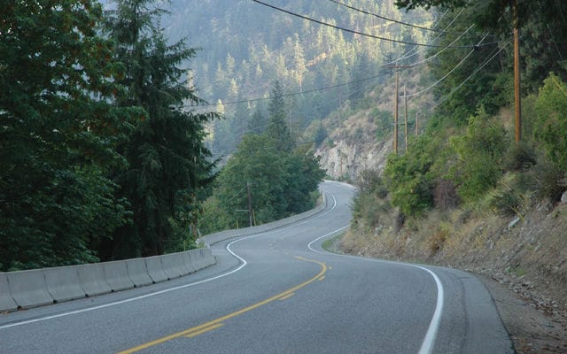
About halfway up the Mount Baker highway, the character of the ride changes. The road coils into loops and whorls like you’d see in a magnified fingerprint, the pavement is a black sheen of asphalt that could have been sprayed on with a paint gun, and some of the curves are so tight I can see the way ahead in my rearview mirrors. We’re in a mountain forest in northern Washington state. Branches incline overhead in green tents and the road climbs aggressively, occasionally crossing a muddy turquoise stream, then switchbacking on itself like a dog with an itch. Up at the top, the air is cool and the ground is covered in snow, so after a short break we head back down, and now that I’m used to the curls, my lines are smoother, my speed more consistent.
Down in the valley we find a small-town café and indulge in apple pie and coffee. Maggie is relaxing—disarmed, I think, because we still haven’t crashed. I have tried to break her in, get her used to slamming an 800-pound motorcycle down a curving road lined with trees and rocks. Shortly after I picked up the Harley, I took her for a spin up a local mountain, right around sundown—what she calls “deer-on-road-time.” I wrapped that bike around those curves for an hour while she sat behind me, clinging to life, tears dissipating in the wind. So bringing her on a five-day trip through Washington might not be the smartest thing I’ve ever done. We’ve had more than one argument about what constitutes safe speed, and before we’d even gotten out of Canada she threatened to take the bus home. I said, “But what am I gonna have for dinner?” I should know better than to make jokes at a time like this — but I don’t, because apparently I’m “retarded.”
But now, having survived the Mount Baker highway, and having dined on homemade pie and excellent coffee, we’re cool; she’s willing to keep going. She even likes the road. The idea for this trip is simple: we’re going to ride the 10 best roads in the state of Washington. We used a motorcycle tour guide called Destination Highways to plan our route, and we have just ticked number eight off our list. I lick my fork and put it down, shrug into my jacket while Maggie gets up and casts a final simmering gaze around the café. The waiter is tall and handsome, a fact that she has mentioned several times. “Leave a big tip,” she orders. I obey. As we motor away, Maggie jabs me in the ribs and points out scenic landmarks: a roadside store named The Beer Shrine, something called Carol’s Girls. She’s laughing.
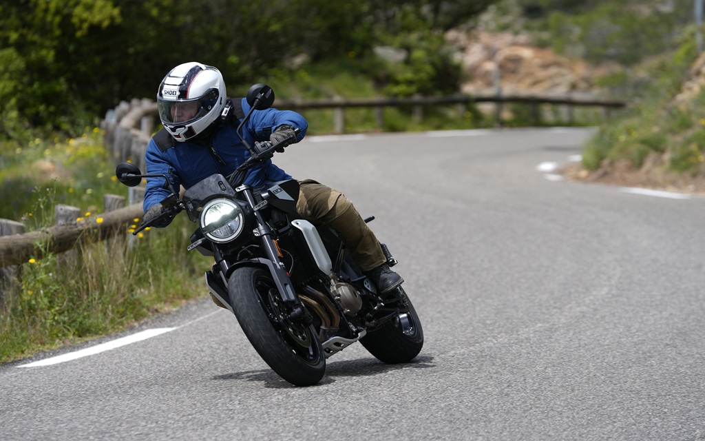
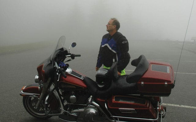
The Electra Glide is long, heavy, and slow. Maggie feels some security in its plush accommodations, but Maggie thinks motorcycles should come with four wheels and a doctor. Every time we see one of the “Motorcycles Use Extreme Caution” signs that the state has sprinkled over its roads, I fear she’ll revolt. Not to worry, the Harley is incapable of any kind of enthusiasm, and we’re loaded down with a week’s worth of gear and a Mac laptop, so knee-dragging is not on the agenda. On a tour of the best sport bike roads in Washington, I’ve brought a Harley-Davidson touring bike and a passenger who refuses to take her feet off the ground. And here comes strike number three: in a summer burning with unremitting sunshine, we have found the missing rain.
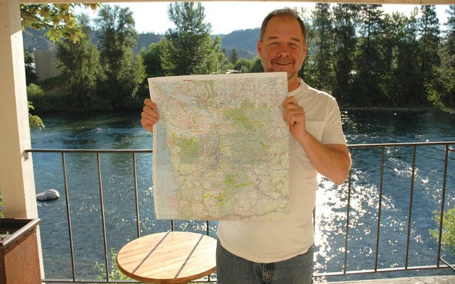
Much later, Maggie will forward to me a series of messages that she e-mailed to her mother from this tour, via the Mactop. In one, she describes the trees that bent over our heads as we climbed Mt. Baker: Underneath, the trunks and the broken branches were covered in a yellow-green moss that glowed in the faint light. She mentions a whole pile of switchbacks, but I recall that she never once complained about scraping footboards, or fought to straighten the bike out of a curve. A couple of weeks before, in the kitchen of our Kamloops home, Maggie and I prepared our trip map, looking up roads in Destination Highways, relocating them on the map, labelling them with Post-It notes: DH-1, DH-2, all the way up to DH-10. These roads are judged by criteria that matter to a motorcyclist—twistiness, scenery, pavement quality, and so on—so any road in the top 10 will be fantastic.
Our route conveniently formed a large circle: after crossing the border near Vancouver we would head east across the North Cascade mountains, then south toward Mt. Ranier National Park, down and west to the Mt. St. Helens volcano, then northwest, up to the Olympic rain forest, a short distance from the Canadian border at Vancouver. We took one saddlebag each, Maggie on the left side, me on the right. Her Mac Book went into the top case, bubblewrapped, and so did our library of maps, Destination Highways Washington, and a pile of rain gear. “You have to bring rain gear, even when you’re sure it’s going to be nice,” I told Maggie. “You never know, it could get chilly.” Day two breaks with a fine rain sifting out of grey wool. Around 9 o’clock, Maggie and I set off, wearing water resistant Joe Rocket jackets and cheap rain pants. We head inland from Sedro Woolley, which lies about 50 miles east of Victoria. Even though we’ve already checked off road number eight, this feels like the true start of our adventure, and it seems weird to start with the best, DH-1. Everything that follows will be inferior.
The North Cascades highway is a hundred miles long, laced with curves and sudden, swinging altitude changes, and wrapped in spectacular, soaring beauty. I had found it a few years earlier, on another motorcycle, and I returned to it now with enthusiasm. It had some meaning for Maggie, too, but I did not know this at the time. I travelled this road about 20 years ago and had fond memories of beautiful green lakes, high mountains and generally impressive scenery, so this road had a bit to live up to. Perhaps it would have done so had it not been for the rain. About 22 miles in, we reach a village called Newhalem, built by the Seattle City Light power company back in the ’30s. We need a break, so we yank the plug. We stopped at a tourist trap and bought fudge and trail mix and Steve bought a Christmas ornament ‘cause it was cheap. In that area there are a bunch of dams on the river and they are all quite proud of their electricity-making abilities so the art in the park is made of large electricity-making parts.
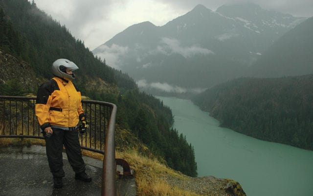
We shoot photos in front of things that look like props from a ’50s science fiction film, then zip up and head out. The road climbs the hill, pauses beside a green lake called Diablo. We pull in at a viewpoint; rain filters down the backs of our jackets and mist seals off the distant views, which are probably spectacular. So now we have been introduced to a theme that will become familiar: I bet that view is spectacular. As we head down the eastern slope of the Cascades, the rain fades, and by the time we hit Winthrop, patches of blue sky have torn through the cloud. But number one has been a bust: cold, wet, and foggy; never have I gone so slow around so many curves. We park and stroll along a downtown boardwalk in Winthrop, a touristy town made to look like preserved history, with a dash of commerce.Winthrop is just how the wild west would be if there were a bunch of stores selling pottery and art in the wild west. The main street is jammed. We duck into a café, order sandwiches. The town has sold out for tourist dollars, but it’s fun, and this food could tame weasels. Even the café washroom makes an impression.
The sink is a beautifully glazed bowl with brushed steel fixtures and soap dispensers on top of an immaculately clean, carved counter with burlap draped ever-so-carefully below. Fed, and warmed by the sun, we head south from Winthrop to Chelan, where we get ice cream sandwiches and then find our next destination highway, a raveled little strip up the side of Lake Chelan that’s rated number five. Soon, it’s behind us. We continue south, then jog northwest on U.S. 97 to a place called Leavenworth. It’s a fake German village full of buses and German tourists, as phony and contrived in its oompa-band Bavarianism as Winthrop was with its Old West movie lot. At least Winthrop was fun.
We backtrack, and get lucky.
Just down the road is Peshastin, a crummy little town with a tired motel on the bank of a river. We get a room for fifty bucks, and the clerk says we’ll have a quiet night—there’s only one other couple, also on a bike—but we’ll have to go upstairs, because the lower rooms are flooded. We hike to the second floor and find a 50-metre-long balcony overlooking the Wenatchee River. We throw our gear in the room, then head back to Leavenworth for some food. After a rather good dinner in Leavenworth at a restaurant that our hotel manager referred to as “a Bavarian Denny’s,” we came back to our beautiful balcony to watch a TV show that I’d loaded on my laptop. The sound of the river made it a little difficult to hear, but how’s that for a problem? The river sparkles in the morning as we drink coffee on the balcony.
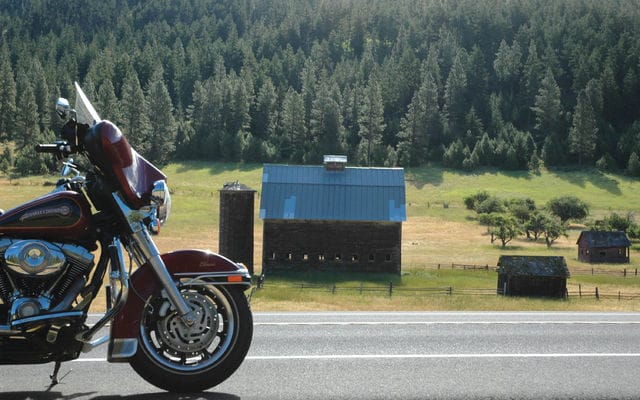
Then we cruise south. Highway 97 has earned a 55th-place spot in Destination Highways. It’s a confection of fast sweepers and smooth, wide pavement, and the air is warm, the sun easy. Traffic is courteous: one guy flashes a peace sign as he moves over to let us pass. Somewhere north of Ellensburg we pull over for a breather. Across the highway is a green field, a barn and some outbuildings, a few trees, the scene rimmed by a backlit, glowing pine forest. You could trade a year of life for a minute of this and come out a winner. Two days later, we approach the volcano under a black sky, following a Corvette into the Gifford-Pinchot National Forest. A drizzle filters through the trees, and the pavement is unreliable—Maggie has spotted a crack that could swallow a wheel—but I’m enjoying the ride, though I dare not proceed briskly. Three of the best roads are right here, clustered around Mt. St. Helens. We’re on number four, but soon we turn onto number two and begin to climb the volcano’s flank.
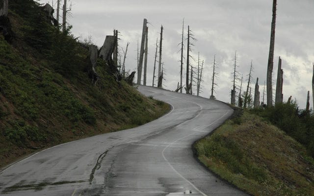
I don’t know how much farther Maggie can go. Yesterday, we rode two of the destination highways on our list, numbers seven and nine at Mt. Ranier National Park, and when I pulled over late in the afternoon, Maggie was in so much pain that she wept as she climbed off the bike. “I don’t think I can go any farther,” she said. Soon after we entered the park we passed through an area where half the road had fallen into the abyss. The road was so bumpy that at one point a drop caused my spine to compress like a spring, but it didn’t bounce back too well. I found a motel, got her tucked into a soft bed, and later bought some blue pills and fried chicken and beer. The pills were pretty good; in the morning, she was still sore, but willing to carry on. So now, Mt. St. Helens lies before us, and as we turn onto number two, the rain lightens. The climb begins, and soon we are in a wasteland of burned trees. There are no branches and there is little undergrowth, just spires of grey wood, like hairs on the back of a spider, and the road drapes over this grey landscape like old string that has been discarded.
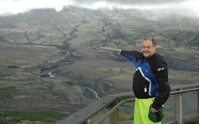
At the top, the view is dreary and flat, colourless and nearly formless. We head back down and ride under the bottom of the park. The next day, we’re on DH-3, which climbs up the western side of the volcano in a long series of loops and switchbacks. This road was built after the 1980 eruption and the pavement is velvet laid against cliffs of red oxide. At the top is a visitor centre and the Johnston Ridge Observatory, which was named for a volcanologist who radioed in a warning just before the side of a mountain hit him at 900 miles an hour. We watch a movie that takes my breath away. When the movie ends, the screen moves aside, revealing through the windows a large cloud. The weather has not been good, but in ways that I would not have predicted, this trip has been pleasurable. And Maggie is holding up pretty well, despite her initial fears and the pain of a hammered spine. She has not written any more e-mails to send to her mother; it’s as if she has traversed the emotional distance from excitement to endurance on this trip—and yet, she finds ways to be cheerful, even now, when she’s about to climb back onto a motorcycle on a burned-over mountain in the rain.
And now we have covered eight of our destination highways; in order: DH-8, 1, 5; 7 and 9; 4 and 2; and today, 3. Only DH-6 and 10 remain for us, but we are in the southwest corner of the state, and they are in the northwest corner, and the weather shows no sign of quitting. What has always been obvious, and has turned into a pleasant reality, is that our top 10 roads are connected by others in the Destination Highways list, so as we carry on we’ll run into number 17, or 22, and the ride to our ride will itself be something to savour. If only it wasn’t for this damn weather. After a momentary diversion into Oregon, we let US 101 carry us up the coast. The afternoon darkens under an increasingly heavy sky, and as we pass through Cosmopolis and then Aberdeen and head into the Olympic Rain Forest, I begin to lose confidence that there will be a warm motel in the forest, on a Saturday night, with a room for two. We pass through Humptulips and Neilton, and we’re just into Olympic National Park when the rain starts.
By the time we pull into a resort at Quinalt, it’s full dark, and I can hardly see, my visor and eyeglasses wet and fogged. A shopkeeper feels so sorry for us that she makes half a dozen phone calls, trying to get us a room, but no luck. We’ll have to ride 40 miles back down the road to Aberdeen. I apologize to Maggie. Her Joe Rocket jacket is leaking, and she’s tired, and no doubt her back hurts, but she smiles and gets on the bike. There are wallows in the road filled with water; they drag on us and the wind pushes us from one side to another in the darkness. I begin to fear, for the first time on this trip, that we are seriously risking our lives as we motor down this night highway. But then a light beckons: a roadside rock and roll bar. Music booms, people are drunk. A skinny waitress serves us pizza. A guy standing in the doorway tries to light his hash pipe but he’s too drunk to get the flame where it has to go. “Watch yourself on that road,” he says.
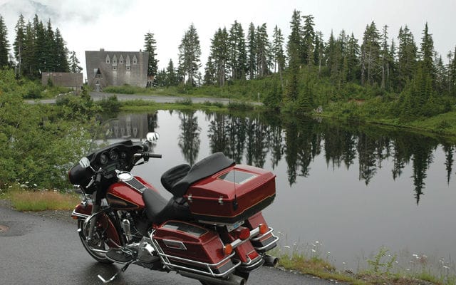
An hour later, we’re opening the door to a motel room, and it feels like we’ve gone too far. Maggie takes my jeans down to the laundromat to dry, then returns to sew a loose strap back onto my rubber pants. “I’m sure glad you didn’t take the bus home,” I say. “I still might,” she warns me, but it’s with that smile. The next day, we see some blue sky as we motor north to find number six at Port Angeles on the northwest coast. It’s an 18-mile ladder up to Hurrican Ridge, where you’ll have a lovely view of the Olympic mountains. The road winds up the mountain in tight curves, and when we pull over for a little break, the wind blows fog away, and the mouth of a tunnel is revealed. As the fog rolls back in, we get back on the bike, ride into the hole in the mountain where the fog can’t follow; it’s momentarily clear in the headlights, and then we plunge back into this grey plug of fluff on the other side.
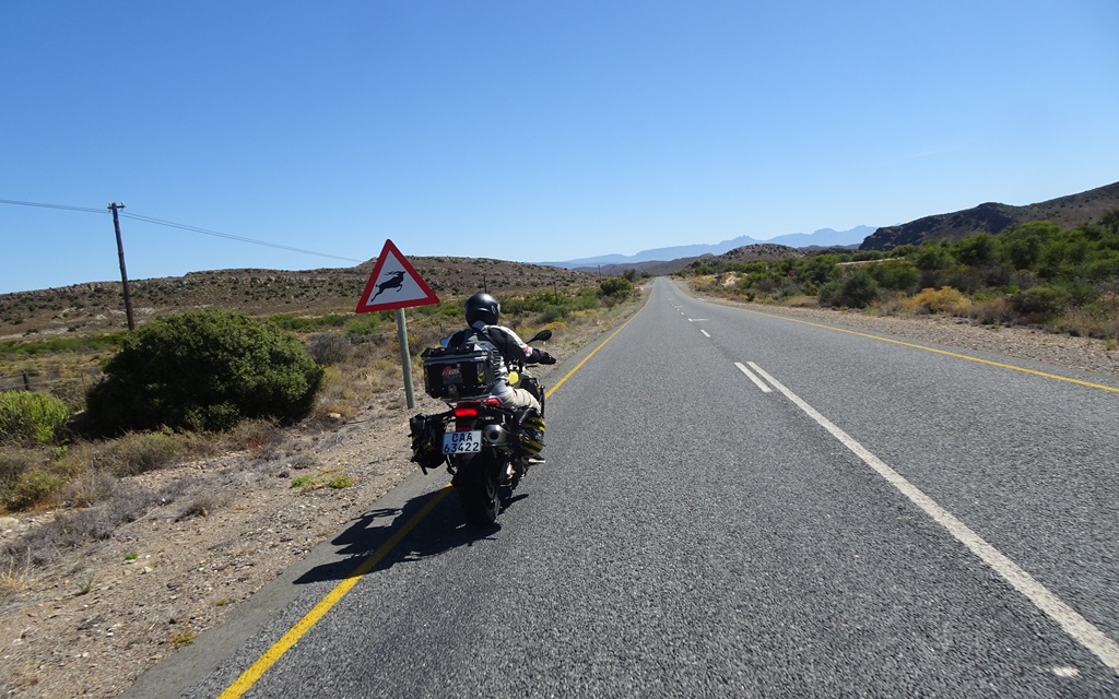
At the top, there’s a visitor centre, so we get warm, have some soup. Buy some junk. Maggie sits across from me in the cafeteria, spooning chicken soup. “This weather isn’t going to get better,” she says. “Let’s not bother with number ten. We can just say we did the top nine.” And for once, she’s right. Cloud and snow cover await the traveller at the top of the Mount Baker highway in northwest Washington state, but it’s a worthwhile ride. Warning signs (below) are liberally sprinkled over the state’s roads, but don’t seem to be associated with any particular threats, other than some occasional bridge reconstruction. Washington is a mountain state, and its best roads tend to be climbers. Diablo Lake is a green jewel in a green jewel, but the spectacular scenery along Washington state’s best road is muted by soggy weather. Below, the sun pops out for a ride along the shore of Lake Chelan, where a short, curve-laced road is DH number five.
A sublime moment: morning sunshine, beautiful scenery, and a pleasant highway can elevate the mood of a traveller, but cracks that could swallow a moose and weather that won’t stop coming can dampen one’s spirits (below). Road up to the Mt. St. Helens volcano is a winding delight, surrounded by a wasteland of burned out trees — it’s eerie and beautiful. From the Mt. St. Helens viewpoint, the devastation wrought by an exploding volcano is usually all too obvious. When Mt. St. Helens blew, it tore the landscape apart, and a quarter-century later, the scars have been softened but are still visible. Inside the visitor centre (left), moving lights on a three-dimensional display show how lava flowed. The road to Hurricane Ridge is short, but sweet — it’s DH number six, and it’s probably surrounded by spectacular scenery, but who can tell? It’s an early, but fitting, end to a ride of the best roads in the state. Weather was a downer, but roads were great, and Harley-Davidson’s Electra Glide made a good mount in trying conditions.